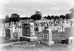
 Objective: Create a comprehensive inventory of burial locations in Baltimore County as a resource tool for Genealogists.
Parameters: Current Baltimore County political boundaries + relocated (in or out).
Current count: about 465 sites with 365 geocoded.
A burial is defined as a location where remains are or were placed anywhere in Baltimore County. This includes cemeteries, family burial plots, Columbariums, relocated burials and locations where burials occurred or were recorded but may now be lost, markers gone, built-over or not clearly identified.
This is a work in progress. Additions, corrections and pictures (preferably electronic) are appreciated. Please contact us if you can add to this genealogical resource. It is not our current goal to enumerate each burial at these locations. Many members of the Baltimore County Genealogical Society have contributed many hours to creating this, but there is much still to do. Additional information may be available at the BCGS Library.
So far, about 365 locations have been placed to a map. ALL of the cemetery names are listed following the map.
Help Us Locate These Cemeteries
Some cemeteries on the map are estimate and a few are not placed the map.
Please review the following file and help us identify a location for these cemeteries.
Select → CEMETERIES TO BE LOCATED
If you have information, please contact Herb Frantz → hrfrantz3@gmail.com
MAP DIRECTIONS for PC Users: On the right side of map is a scrolling sidebar. Scroll down to an alphabetical list of the sites. When you find a burial site of interest, you can click on the name and be taken to that spot on the map.
TABLET Users: The sidebar may not appear. Select the PDF file for the cemetery list.
 Select the image on the right →
To view map in a full screen.
View with a map from 1866 → historic map
BALTIMORE COUNTY CEMETERY LIST
With and without geocodes – Updated 30 October 2016
Select this HTML file → BCGS BURIAL SITE LIST
Information is collected to identify, locate and describe the site. The basic data elements are:
- Name – In some cases the actual name is unknown, but in may be based from legal records, Newspapers, death certificates, BCGS research, historical records or assigned by a family surname.
- Location – local area nomenclature
- Zip code
- ADC map – Baltimore & County, Maryland (25th edition)- Page & Grid
- Directions (at final location)
- GPS location – metric (EGM2008 std)
- Lat. / Lon. estimated – Set to Yes, if only the ADC map coordinates are known.
- Notes – Comments to clarify or expand information
- URLs (Uniform Resource Locator) – relevant links
- Burial Dates (earliest & latest) – If known
- Alternative Burial Site name(s) – Aliases if known
- Data available at the BCGS Library – set to YES or blank.
** ADC is the Alexandria Drafting Company. Their printed maps are out-of-print.
- View the Burial Project Data Collection in
- HTML format
- PDF sheet (2 pages)
Additional Sources:
- Baltimore County Genealogical Library holdings – additional data maybe available.
- Historical Society of Baltimore County holdings
- Pictures (if available at the BCGS Library)
The following is not working and is under development:
You may view the 1866 map without any markers and with an adjustable transparency by selecting THIS LINK. When the screen appears, you can adjust the transparency by moving the slider bar in the upper right corner.
